The Rasuwa Flood of August 26, 2026: How a Glacier Collapse Became Nepal's Costliest Disaster in Years
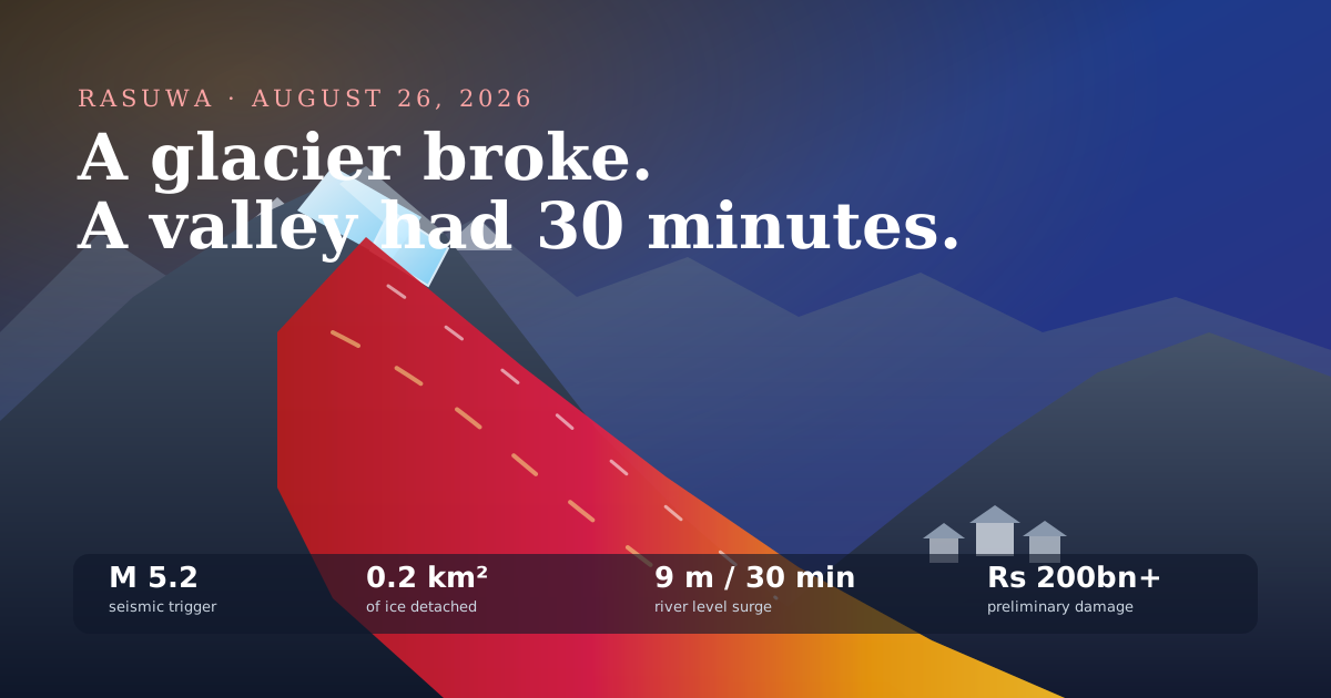
A magnitude 5.2 tremor dislodged 0.2 km² of ice at 5,200 metres. Within hours, a debris dam breached and river levels rose 9 metres in 30 minutes. Here is the full anatomy of the disaster — the physics, the toll, the Rs 200 billion damage estimate, and the response.
A magnitude 5.2 seismic event near the Nepal–China (Tibet) border on the morning of August 26, 2026 dislodged roughly 0.2 square kilometres of glacier ice at around 5,200 metres. The ice-and-rock avalanche fell into the valley and temporarily dammed the river. When that natural dam breached, it released a glacial lake outburst flood (GLOF) — a debris flow of mud, water, boulders and ice that surged downstream with almost no warning.
Get new posts in your inbox
No spam, unsubscribe anytime.
About the Author
Sujit KarkiFinance Researcher & Market Analyst
Independent finance researcher and market analyst with expertise in macroeconomics, equity markets, and personal finance. I help regular investors make better-informed decisions through rigorous, data-driven analysis.
On the morning of August 26, 2026, a magnitude 5.2 seismic event near the Nepal–China border dislodged roughly 0.2 km² of glacier ice at about 5,200 metres, which fell into the valley and temporarily dammed the river.
When that debris dam breached, it produced a glacial lake outburst flood (GLOF). River levels surged by as much as 9 metres in 30 minutes — a wall of mud, boulders and ice rather than clear water.
As of August 29, the confirmed death toll stands at at least 353, with more than 400 still missing, including over 100 Indian tourists and 37 non-resident Indians, many of them Kailash Mansarovar pilgrims.
Preliminary government damage estimates exceed Rs 200 billion — highways, bridges, hydropower, six downed transmission lines, the destroyed 220 kV Trishuli substation, telecom towers, and the Rasuwagadhi customs facility.
The Cabinet declared Rasuwa, Nuwakot and Dhading crisis zones for three months and released Rs 25 million in immediate district relief — roughly one eight-thousandth of the preliminary damage estimate, which tells you exactly what that money is for.
There is a particular kind of disaster that does not announce itself. No monsoon warning, no rising-water bulletin on the radio, no three days of heavy rain to watch nervously from the window. Just a tremor most people barely registered, somewhere up near the border, and then — perhaps an hour later, perhaps less — the sound.
That is what happened in Rasuwa on the morning of August 26, 2026. This post is my attempt to lay out everything that is currently established about it in one place: the physical mechanism, the human toll, the economic damage, the medical and rescue response, and the government's decisions. I have tried to be scrupulous about the difference between what has been confirmed, what is a preliminary official estimate, and what is inference. In a disaster this fresh, that distinction is the whole ballgame.
Every number in this post is provisional
This was written on August 29, 2026 — three days into an active search-and-rescue operation. Death tolls in disasters of this type almost always rise as missing persons are reclassified. Damage estimates almost always move as engineers reach sites they could not previously access. Treat the figures here as the official picture as of publication, not as a final accounting, and check the primary trackers listed at the end before quoting any of them.
What happened on August 26
The compressed version: a moderate earthquake near the Nepal–China (Tibet) border knocked a large mass of ice off a high glacier. The ice and rock crashed into the valley below and blocked the river. The blockage held long enough to pond a significant volume of water behind it, then failed — not gradually, the way an engineered spillway releases, but all at once. The resulting debris flow ran down the Trishuli valley, through Timure and Syabrubesi, past Rasuwagadhi, and onward into Nuwakot and Dhading, carrying enough energy to move boulders, demolish bridges, and strip riverside settlements off their foundations.
Confirmed dead0Official figure as of August 29, 2026
Reported missing0More than — includes 100+ Indian tourists
River level surge0Metres, within 30 minutes
Preliminary damage0Billion rupees, government estimate
Those four numbers are the disaster in outline. The rest of this post is the shape underneath them.
Flowchart · the cascade
How one moderate earthquake produced a 9-metre wall of debris
1
Magnitude 5.2 seismic event
T + 0
Near the Nepal–China (Tibet) border, morning of August 26, 2026. Moderate on its own — destructive because of what it was sitting under.
2
Glacier detaches at ~5,200 m
minutes
Satellite imagery indicates roughly 0.2 km² of ice broke away and fell into the valley — an ice-and-rock avalanche, not rainfall.
3
Debris blocks the river
minutes to hours
The avalanche deposit dammed the channel. A landslide dam is unengineered, unmonitored, and holds only until it does not.
4
The dam breaches
sudden
Impounded water cut through the debris at once rather than draining gradually — the classic outburst mechanism (GLOF).
5
Debris flow hits settlements
≈ 30 min
River levels rose by as much as 9 metres in 30 minutes downstream. Not clean water — a slurry of mud, boulders, and ice.
Every stage after the first is a physical process, not a weather forecast. That is why no rain warning existed to issue — and why stage 5 arrived before anyone downstream knew stage 2 had happened.
The thing I want you to notice about that sequence is that only the first step is an earthquake. Everything after it is gravity and water doing entirely predictable things to entirely unstable terrain. A magnitude 5.2 event is not, by itself, a catastrophe — Nepal experiences tremors in that range with some regularity and they usually make the news for a day and then do not. It became a catastrophe because of what happened to be sitting above the valley, and because there was nothing between the collapse and the settlements that could carry a warning faster than water travels downhill.
The trigger: a moderate earthquake in exactly the wrong place
Let me be precise about the seismology, because it is where a lot of early coverage went slightly wrong.
The magnitude 5.2 event near the Nepal–China border did not destroy anything by shaking. In a country whose building stock was significantly upgraded after 2015, a 5.2 is a bad morning, not a disaster. Structural damage from ground motion at that magnitude, at that distance, would be limited and localised.
What it did instead was act as a trigger on a system that was already loaded. High-altitude glacier ice sits on rock at angles that are marginally stable in the best conditions. Warm-season melt lubricates the bed underneath it. Meltwater works into fractures and refreezes. By late August, at the tail of the monsoon and the warm season, a Himalayan glacier's toe is about as close to letting go as it gets in the annual cycle. The tremor supplied the last increment of energy.
Satellite imagery reviewed after the event indicates that roughly 0.2 square kilometres of ice detached at around 5,200 metres elevation. That is a useful number to sit with for a moment. Two-tenths of a square kilometre is about twenty-eight football pitches of ice. Depending on thickness — and glacier ice at that elevation is routinely tens of metres thick — you are talking about a mass measured in millions of tonnes, released onto a slope with several kilometres of vertical drop beneath it.
Why the elevation matters more than the magnitude
Potential energy scales with height. A mass falling from 5,200 metres into a valley floor thousands of metres below arrives with an enormous amount of kinetic energy to spend on whatever is in the way — and ice-rock avalanches entrain everything they cross, growing in volume as they descend. The magnitude 5.2 is the headline, but the 5,200 metres is the number that did the damage.
Diagram · longitudinal profile
From 5,200 metres to the Chitwan plains
Schematic, not to scale. Vertical exaggeration is extreme — the point is the sequence of what the flow passed through, not the gradient.
Elevations are approximate settlement elevations, included for scale. Every place on this line received the flow within hours of the detachment.
The chain reaction: why the dam was more dangerous than the quake
Here is the part that separates a bad landslide from a disaster that kills hundreds.
When the avalanche reached the valley floor, it did not simply stop. It came to rest across the river channel, and in doing so it built a dam. Not a metaphorical one — a genuine barrier of ice, rock and debris tens of metres high, spanning a river that had nowhere else to go.
A landslide dam is one of the most dangerous transient structures in nature, for reasons that are almost entirely about engineering that is not there:
It has no spillway. An engineered dam has a controlled path for excess water. A debris dam has only the top of itself.
It has no core, no compaction, no design. It is loose material stacked by an avalanche. Water percolates through it and erodes it internally.
It is unmonitored. Nobody is reading a piezometer inside it. Nobody knows how much water is behind it or how fast that volume is rising.
It fails catastrophically rather than gradually. Once overtopping or internal erosion cuts a channel, the flow through that channel widens the channel, which increases the flow, which widens it further. The failure is self-accelerating.
That last property is the one that killed people. The stored water did not seep out over a day. It came out in one release, and it came out carrying the dam with it — which is why what arrived downstream was not a flood in the ordinary sense but a debris flow: a dense slurry of water, mud, sand, boulders and shattered ice, with a bulk density far above that of water and a correspondingly greater capacity to destroy anything it hits.
What a normal monsoon flood does
Rises over hours, with upstream gauges giving downstream communities lead time
Follows a broadly predictable seasonal and daily pattern tied to rainfall
Carries mostly water and suspended silt — damaging, but survivable at the margins
Leaves buildings standing and often repairable above the waterline
Can be forecast days ahead from meteorological data alone
What a GLOF debris flow does
Arrives as a front, in minutes, with no meteorological precursor to forecast
Triggered by geology, not weather — no rain warning exists to issue
Carries boulders and ice at speed; impact force, not just inundation, is the killer
Scours foundations and removes structures rather than flooding them
Can only be detected by upstream instrumentation, which mostly does not exist here
I have seen a fair amount of commentary asking why residents did not move to higher ground. The honest answer is contained in the two columns above. Riverside communities in Nepal have deep, well-earned instincts about monsoon flooding — they know what a rising Trishuli looks like and they know when to go. Those instincts are calibrated to a phenomenon that gives you hours. This gave them minutes, and it gave them no warning signal at all beforehand.
Nine metres in thirty minutes
The single most-quoted figure from this disaster is that river levels surged by as much as 9 metres within 30 minutes. It deserves unpacking, because the number is easy to read past.
Nine metres is roughly the height of a three-storey building. Thirty minutes is the length of a tea break. Now stop imagining clear water, because that is not what nine metres of this was. Debris flows of this type routinely run at bulk densities well above water, meaning the mass hitting a structure at a given depth and velocity delivers substantially more force than the equivalent depth of a clean-water flood would.
Interactive · illustrative model
What “9 metres in 30 minutes” actually looks like
Drag the clock. The curve is an interpolation to the single reported figure — treat it as a way to picture the scale, not as a gauge record.
Minutes since the surge front arrived30 min
030 (reported peak)45
1.7 m
3 m
4.5 m
6 m
9 m
River level above normal
9.0 m
Roughly 30 feet of mud, water, boulders and ice — not clear water.
Under water at this level
An adult standing1.7 m
Single-storey roofline3 m
A loaded truck4.5 m
Two-storey house6 m
Reported peak rise9 m
The entire useful evacuation window sits in the first few minutes of this slider. That is the whole argument for automated upstream sensing in this valley.
The operationally important feature of that curve is not the peak. It is the steepness in the middle. By the time the rise is unmistakable to someone standing on the bank — say, two metres — you have somewhere in the region of fifteen minutes before the peak. Fifteen minutes is not enough time to wake a household, gather children and elderly relatives, and climb a valley wall. In several of the worst-hit locations, people simply did not have a usable window at all.
This is why the entire technical conversation about preventing the next one is a conversation about upstream detection, not about downstream defences. There is no wall you can build in Syabrubesi that meaningfully changes the outcome. There is, however, a sensor you can put upstream that buys twenty minutes — and in a curve shaped like that one, twenty minutes is the difference between a tragedy and a near-miss.
The human toll
As of August 29, the official death toll stands at at least 353. More than 400 people remain missing.
Those two numbers should be read together rather than separately, because in a debris-flow event the boundary between them is administrative rather than physical. Bodies have been recovered far downstream, in Nuwakot, Dhading and as far as Chitwan — which is to say the flow carried people well over a hundred kilometres from where it took them. Recovery in that context is slow, incomplete, and dependent on river conditions that are themselves still unstable.
Beyond the dead and missing sit the displaced. Hundreds of families have lost their homes outright, concentrated in Syabrubesi and Timure — the two settlements that took the flow most directly. "Lost their homes" understates it in the specific way that debris flows do: these are not damaged houses awaiting repair. In the worst-affected riverside stretches, the land the houses stood on has been scoured away. There is no foundation to rebuild on, and in many cases no legal certainty about where the plot boundary now is.
A note on how these figures will move
In disasters with large missing counts and long recovery distances, the confirmed death toll typically rises for weeks. It is also common for the missing figure to fall for two entirely different reasons that get conflated in reporting: bodies being identified, and people who were listed missing being found alive elsewhere. When you see the numbers change, look for which of those two things happened before drawing a conclusion.
Why so many foreign nationals were in the valley
One feature of this disaster that surprised a lot of international readers is the number of foreign nationals among the missing: more than 100 Indian tourists and 37 non-resident Indians.
That is not coincidence. The Rasuwa corridor is not a remote valley that happens to have a few visitors in it. It is one of Nepal's principal overland routes to Tibet, and in August it is carrying two distinct streams of people at once.
The first is the Kailash Mansarovar Yatra — the pilgrimage to Mount Kailash and Lake Mansarovar in Tibet, sacred in Hinduism, Buddhism, Jainism and Bön. A substantial share of pilgrims travel overland through Nepal, entering Tibet via the Rasuwagadhi crossing. The pilgrimage season runs through the summer months, which places large groups of Indian pilgrims in exactly this valley in exactly this week.
The second is trekking. Syabrubesi is the road head and gateway for the Langtang trekking region — for most trekkers, the trailhead is literally the far end of the Syabrubesi bus park. Hundreds of trekkers were stranded when the town's infrastructure was destroyed and the highway out was severed.
I want to name something uncomfortable here, because it shapes coverage. Disasters that kill foreign nationals get more international attention than disasters that kill only locals. The Rasuwa flood is being covered widely in Indian media substantially because of the pilgrims. That attention is genuinely useful — it drives aid and diplomatic urgency — but the overwhelming majority of the people who died in this valley were Nepali, and most of them were from households in Rasuwa and Nuwakot that had nothing to do with tourism at all.
The Rs 200 billion question: where the damage actually sits
Preliminary government estimates put the economic damage above Rs 200 billion. At prevailing exchange rates that is on the order of USD 1.4 billion.
Two caveats before we go further, and they matter.
First, a figure produced three days into an emergency, while engineers still cannot physically reach several affected sites, is a first-pass estimate. It is the government's honest attempt at an order of magnitude, not a loss adjustment. Second — and this is the caveat I most want readers to hold onto — no official sector-by-sector breakdown of that Rs 200 billion has been published. What has been published is a list of sectors that sustained heavy damage, with specific assets named. Anyone showing you a neat pie chart of "Rs X billion to hydropower, Rs Y billion to roads" three days in has invented the split. I am not going to do that here.
What I can do is set out what is actually confirmed damaged, sector by sector.
Confirmed damage by sector — Rasuwa flood, as reported through August 29, 2026
Sector
What is confirmed damaged
Why the knock-on effect is larger than the asset
Transport
Prithvi and Pasang Lhamu highways damaged; multiple bridges destroyed; transport severed between Kathmandu and seven districts
Every other sector's recovery runs over these roads. Until they reopen, relief, engineers and reconstruction materials all move by helicopter.
Energy
Hydropower plants severely damaged; six transmission lines disrupted; the 220 kV Trishuli substation completely destroyed
A substation is a node, not a line. Losing it de-energises everything downstream of it regardless of whether that equipment was touched.
Border trade
Rasuwagadhi customs office heavily damaged; the crossing to Tibet is effectively out of service
This is one of Nepal's main overland trade gateways with China. The loss is a flow of customs revenue and goods, not just a building.
Tourism
Syabrubesi suffered massive structural damage; hundreds of trekkers stranded; the Langtang gateway is out of action
Autumn is Nepal's peak trekking season. The damage lands weeks before the revenue that a whole local economy plans its year around.
Telecommunications
Telecom towers in Rasuwa and Nuwakot swept away
This degraded the rescue operation's own coordination — the disaster damaged the tool needed to respond to the disaster.
Housing and land
Hundreds of homes destroyed, concentrated in Syabrubesi and Timure
Scoured land cannot simply be rebuilt on. Resettlement, not reconstruction, is the honest description of what is needed.
Now, the comparison I actually think is the most revealing one in this whole event:
The Rs 25 million released across the three districts is not reconstruction money and was never meant to be. It is fast money — cash that can be spent this week by a district disaster management committee on tarpaulins, food, fuel and vehicle hire without waiting for a procurement process. Judging it against the Rs 200 billion figure is a category error, and I have seen a fair bit of commentary making exactly that error. The correct question is not "why so little" but "what is the mechanism that funds the other Rs 199,975 million, and how long does it take to stand up." That question does not have a good answer yet.
For scale: against a national economy on the order of Rs 6 trillion, a Rs 200 billion loss is in the region of three percent of annual output, concentrated in three districts and delivered in a single morning. I offer that as an order-of-magnitude comparison rather than a precise macroeconomic claim — the correct fiscal impact depends on what share is insured (in Nepal, very little), what share is public infrastructure, and how much of the reconstruction is externally financed.
Energy: what losing a 220 kV substation means
Of all the individual assets on that damage list, the one I would flag to a reader who does not follow power systems is the 220 kV substation at Trishuli, described as completely destroyed, alongside disruption to six transmission lines.
Here is why that specific loss punches above its weight.
A transmission line is a link. A substation is a node — the place where voltage is stepped between levels, where multiple lines meet, where the flow is switched and protected. Lose a span of line and you can often reroute around it. Lose the substation and everything that connects through it is de-energised whether or not a single one of those downstream assets was touched by the flood. The generation upstream may be intact and the distribution network downstream may be intact, and it does not matter, because the thing that joins them is gone.
Substations also have a brutal replacement profile. Large power transformers are not warehouse stock. They are built to order, they have long manufacturing lead times, they are extremely heavy, and — the part that matters most here — they are moved by road. In a corridor where the highways and bridges are themselves destroyed, the logistics of getting replacement equipment to the site is a genuinely hard problem that has to be solved after the road problem is solved.
The dependency that catches people out
Telecom towers need power. Water treatment needs power. Hospitals run generators, and generators need fuel, and fuel arrives by road. The reason engineers were directed to prioritise road access, drinking water and telecommunications in that order is that those three unlock everything else. A relief operation is a dependency graph, and roads sit at the root of it.
Trade and tourism: the two economies of the Rasuwa corridor
Rasuwa's economy runs on two things, and this flood hit both simultaneously.
Trade. The Rasuwagadhi crossing is one of Nepal's principal overland gateways to China, carrying a meaningful share of the country's northern trade. The customs office there was heavily damaged and the approach road along the Pasang Lhamu Highway was cut in multiple places. The commercial consequence is not confined to Rasuwa: importers in Kathmandu who route goods through this crossing now face rerouting costs and delays, and the customs revenue that flows to the national treasury through this point stops flowing until the facility is functional again.
Tourism. Syabrubesi is not incidentally a tourist town — it is the road head for the entire Langtang trekking region, one of the three trekking areas closest to Kathmandu and a mainstay of the autumn season. The town suffered massive structural damage at the end of August, which is to say roughly a month before the peak trekking season that a large number of local households depend on for the bulk of their annual income.
That timing deserves emphasis. Lodge owners, porters, guides, jeep drivers, shopkeepers and teahouse operators in this valley earn a disproportionate share of their yearly income in October and November. The physical damage is one loss. The lost season on top of it is a second, and for many households the second will be larger than the first.
There is a grim historical rhyme here for anyone who knows the region: Langtang village was destroyed by an avalanche during the 2015 earthquake, with enormous loss of life, and the valley's tourism economy took years to rebuild. The community that painstakingly reconstructed that trade over a decade is the community that just lost its road head.
The medical response
The medical response was organised around one constraint that shaped everything else: the roads were gone, including the road to the hospital that would ordinarily have received casualties.
A joint medical task force was dispatched to Nuwakot District Hospital, composed of:
15 doctors from the Nepal Army
12 doctors from the Nepal Police
15 doctors from the Armed Police Force
That is 42 doctors from three separate security services operating under a single deployment — a genuinely non-trivial piece of coordination to execute inside 48 hours.
When road connections to Trishuli Hospital were severed, the Army did the only thing available and moved the hospital instead of the patients: a team of 20 specialists, including two surgeons, was deployed to run a field treatment centre at the Maithali Barracks. A field centre with surgical capability is a meaningful capability — it means the patients who cannot survive a helicopter transfer to Kathmandu have somewhere to be stabilised.
In Kathmandu, the government mandated free treatment for all flood victims and reserved 100 beds across major facilities — the Trauma Centre, Bir Hospital, and Tribhuvan University Teaching Hospital — specifically for airlifted casualties.
The four-layer medical chain built in the first 72 hours
Layer
Where
Capability
Why it exists
Point of injury
Rasuwa, upper Nuwakot
Helicopter extraction, first aid
Road access to the worst-hit settlements does not exist
Field
Maithali Barracks
20 specialists including 2 surgeons
The road to Trishuli Hospital was severed
District
Nuwakot District Hospital
42-doctor joint task force
Nearest functioning district facility receiving casualties
Tertiary
Kathmandu — Trauma Centre, Bir, TU Teaching
100 reserved beds, free treatment
Definitive care for airlifted critical cases
The structure above is textbook disaster medicine — stabilise forward, evacuate rearward, reserve tertiary capacity in advance so arrivals are not competing with routine admissions. What is notable is not the design but the speed, in a country where the receiving hospitals were reachable only by air.
Search and rescue, by air
With the highways severed, the rescue was flown.
Up to 14 helicopters, government and private, were mobilised — alongside drones for locating stranded groups and sniffer dogs for searching debris. More than 250 survivors have been airlifted to safety. The Nepali Army, Armed Police Force and Nepal Police were all deployed in strength.
Dashboard · the official response
What was actually deployed, by category
14
Helicopters mobilised
Government and private aircraft flying together
250+
Survivors airlifted
Lifted out of cut-off settlements
3
Security forces deployed
Nepali Army, Armed Police Force, Nepal Police
Drones + dogs
Search assets
Used to locate people trapped in debris
With the highways severed, aviation was not a supplement to the road response — for several days it was the response.
A few observations about that operation that I think are worth drawing out.
Fourteen helicopters is a lot, in this context. Nepal's total civil helicopter fleet is small, and a significant fraction of it flies commercial and rescue work in the mountains. Mobilising up to fourteen airframes onto a single valley, mixing state and private operators under one tasking authority, effectively consumes the national rotary-wing capacity for the duration.
Drones matter more than they sound like they do. In a debris field, the hardest problem in the first days is knowing where to look. Survivors are cut off in ones and twos on the wrong side of a destroyed road, invisible from the air at speed and unreachable on foot. A drone can sweep terrain that would take a ground team a day to cross, and it does not need the road either.
The comms damage compounded everything. Telecom towers in Rasuwa and Nuwakot were swept away. Coordinating fourteen aircraft, three security services and multiple ground teams across a valley with degraded communications is materially harder than the same job with a functioning network, and it is a good part of why restoring telecommunications was named an engineering priority alongside roads and drinking water.
What the government actually did, and how fast
Stripping out the politics, here is the decision sequence.
Timeline · 72 hours
From the tremor to the crisis-zone declaration
Aug 26, morningTrigger
A magnitude 5.2 seismic event near the Nepal–China border dislodges roughly 0.2 km² of glacier ice at about 5,200 metres.
Aug 26, within hoursImpact
The debris dam breaches. River levels surge by as much as 9 metres in 30 minutes. Syabrubesi and Timure are overwhelmed with effectively no warning.
Aug 26, same dayResponse
Army, Armed Police Force and Nepal Police mobilise. Helicopters begin lifting survivors out of settlements the roads can no longer reach.
Aug 26–27Cascade
Six transmission lines go down and the 220 kV Trishuli substation is destroyed. Telecom towers in Rasuwa and Nuwakot are swept away, degrading the rescue’s own communications.
Aug 27Medical
A joint 42-doctor task force reaches Nuwakot District Hospital. With the road to Trishuli Hospital cut, the Army stands up a field treatment centre at Maithali Barracks.
Aug 27–28Declaration
The Cabinet declares Rasuwa, Nuwakot and Dhading local governments crisis zones for three months, and releases Rs 25 million across the three district disaster funds.
Aug 28–29Aid
A toll-free missing-persons hotline (1234) goes live. India delivers 10 tonnes of humanitarian aid; other donor agencies pledge support. Confirmed deaths pass 350; more than 400 remain missing.
The individual decisions, and what each one is actually for:
Crisis-zone declaration. The Cabinet declared the local governments in Rasuwa, Nuwakot and Dhading disaster crisis zones for three months. This is a legal instrument, not a statement of sympathy — a crisis-zone declaration changes what local authorities are permitted to do without going through normal process, including emergency procurement, requisitioning, and movement restrictions.
Immediate district funds.Rs 10 million each to Rasuwa and Nuwakot, Rs 5 million to Dhading, paid straight into district disaster management funds. As discussed above, this is deliberately fast, deliberately small money whose purpose is to let a district committee buy things this week.
Movement restrictions. Travel was banned on high-risk highway sections and riverbank areas downstream were evacuated. This is the least popular category of disaster decision and usually the most valuable one. Landslide-dammed rivers do not always fail once; upstream instability after an event of this size persists for weeks, and secondary surges are a real risk to anyone who has gone back to their house on the bank.
The 1234 hotline. A toll-free missing-persons line. With more than 400 people missing across multiple districts and several nationalities, a single national number is the difference between a coordinated missing-persons database and a hundred separate lists that never reconcile.
Engineering priorities. Ministries and army engineers were directed to prioritise road access, drinking water and telecommunications. That ordering is correct and worth understanding: roads unlock the delivery of everything else, water prevents the second wave of casualties that follows every flood disaster (waterborne disease in displaced populations), and telecoms restore the coordination capacity the rescue itself depends on.
The metric to watch over the next month
Not the death toll — that will keep rising mechanically as recovery proceeds, and it tells you nothing new about the response. Watch road reopening and shelter-in-place capacity before the cold. Rasuwa sits high. Displaced families in tarpaulin shelters at altitude going into autumn is the second disaster that follows this kind of event, and it is the one that is genuinely preventable.
International assistance
Nepal appealed for humanitarian support, and multiple international donor agencies have pledged assistance. India has already delivered 10 tonnes of humanitarian aid.
Two honest observations here.
The first is that 10 tonnes, delivered within days, is a meaningful early contribution — early aid is worth disproportionately more than late aid — and it also reflects the fact that a large number of Indian nationals are among the missing. Both things are true at once, and neither diminishes the other.
The second is about what the aid conversation looks like in a month. Emergency relief — food, shelter, medical supplies — is the easy part of international assistance to mobilise, and Nepal has a well-practised system for absorbing it. The hard part is reconstruction finance: a Rs 200 billion damage estimate against a public budget that had no line for it, in a country with very low insurance penetration where the state ends up as the insurer of last resort by default. That negotiation happens quietly, over months, and it will not get a fraction of the coverage the helicopter footage got. It is also the thing that will determine whether Syabrubesi has a functioning bus park in two years.
Why Himalayan outburst floods are getting more frequent
I want to close the analytical section by placing this event in its context, carefully, without overclaiming.
Glacial lake outburst floods are not new in Nepal. The country has a long documented history of them, and the underlying hazard has been studied for decades — most systematically by ICIMOD, the Kathmandu-based mountain research centre, which maintains inventories of glacial lakes across the Hindu Kush Himalaya and has repeatedly flagged a subset as potentially dangerous. Nepal has thousands of glacial lakes; a much smaller number are considered high-risk.
What is changing is the environment those lakes sit in. As glaciers retreat, meltwater ponds behind moraine dams that were never designed to hold anything, and those lakes grow. Permafrost that has held high-altitude rock and ice together for millennia is warming, which reduces slope stability at exactly the elevations where large masses of ice sit on steep bedrock. The consequence is that the standing inventory of "things that could let go" is growing, and the trigger required to release any one of them is getting smaller.
What this event is and is not evidence of
This flood is an instance of a hazard class that scientists have been documenting and warning about in the Himalaya for years, and its proximate trigger was seismic rather than meteorological. That is different from saying climate change caused this specific event, which is a claim that requires attribution work nobody has done yet three days in. The defensible statement is narrower and still alarming: the conditions that make ice-rock detachments and outburst floods possible are becoming more common across the range, and the exposure sitting downstream of them — roads, hydropower, border towns, trekking infrastructure — has grown substantially in the same period.
That second half is the part that gets underweighted. Hazard is only half of risk; the other half is exposure. Over the last two decades, the Rasuwa corridor has acquired a highway, a border trade facility, hydropower projects, transmission infrastructure and a tourism economy — all of it, necessarily, in the valley bottom, because in this terrain the valley bottom is the only place to put anything. The hazard has risen somewhat. The value of what sits in the flow path has risen enormously. Multiply those together and you get a Rs 200 billion morning.
What would actually have saved lives
Given the curve in that surge chart, here is my honest read on what changes the outcome next time, ordered by how much difference it makes per rupee.
1. Upstream detection and automated alerting. This is the single highest-value intervention and it is not close. Water-level and seismic sensors upstream of populated reaches, wired to sirens and cell broadcast, with no human in the decision loop. The whole game is converting zero minutes of warning into fifteen or twenty. Systems of this type exist and have been piloted in the region; the challenge has always been maintaining them in remote terrain and funding them between disasters, when nobody is looking.
2. Enforced setbacks in reconstruction. When Syabrubesi and Timure are rebuilt, the question of how close to the river the new buildings sit will be decided by land availability and cost, and the honest answer is that the pressure will be to rebuild exactly where things were. Resisting that requires a decision made now, at the political level, with land offered elsewhere — not a rule written later and waived case by case.
3. Route redundancy. A single highway that severs and disconnects seven districts is a design that guarantees the relief operation becomes an aviation problem. Redundant road access is expensive and unglamorous, and it is the difference between trucks and helicopters in the next event.
4. Standing rotary-wing surge capacity. The fourteen-helicopter response worked, but it worked by consuming essentially all available national capacity. A pre-arranged framework with private operators — rates, tasking authority and priorities agreed before the disaster rather than during it — removes friction from hour one.
5. Communications hardening. Towers in the flow path will be lost. Satellite backhaul for district emergency operations centres, pre-positioned and tested, means the response does not lose its coordination layer at the moment it needs it most.
None of these are exotic. Every one of them is a budget line that competes, in an ordinary year, against things with more visible returns. That is the actual reason they do not exist, and it is worth saying plainly rather than pretending the problem is technical.
How to verify these numbers yourself
Because everything here is provisional, I would rather teach the check than ask for trust. If you are quoting any figure from this post a week from now, re-verify it against a primary source first.
Casualty and displacement figures — Nepal's National Disaster Risk Reduction and Management Authority (NDRRMA) and the government's disaster portal are the authoritative national trackers, and they are updated as recovery proceeds.
Hydrology and river conditions — the Department of Hydrology and Meteorology publishes river-level data and warnings.
Regional glacial-lake and GLOF context — ICIMOD is the standing research authority for the Hindu Kush Himalaya and publishes both inventories and post-event analysis.
Global seismic parameters — the USGS earthquake catalogue is the neutral reference for the magnitude, depth and location of the triggering event.
Power restoration status — the Nepal Electricity Authority publishes outage and restoration updates, which is where a substation replacement timeline would surface first.
A rule of thumb for reading disaster coverage
When a report gives you a single number with no date attached — "353 dead" with no "as of" — it is already stale, and you cannot tell how stale. Every credible disaster figure carries a timestamp. If a source does not give you one, find one that does before you repeat it.
How to help
I am not going to publish a list of donation links I have not verified, because disaster fundraising attracts fraud faster than almost any other category, and a bad link on a blog post does real harm. What I will offer instead is the filter I use:
Prefer organisations already operating in Nepal before August 26, over entities created in response to this event. Standing operational presence is the difference between money that becomes tarpaulins in Rasuwa and money that becomes an overhead line item.
Prefer unrestricted funding where the organisation is credible. Restricted donations feel more accountable and are frequently less useful — the responder, not the donor, knows whether this week's binding constraint is fuel, blankets or helicopter hours.
Check the government channel. Nepal's Prime Minister's Disaster Relief Fund is the official domestic mechanism, and district disaster management committees in Rasuwa, Nuwakot and Dhading are the bodies actually spending at the point of need.
Verify before you send, every time. Go to the organisation's own site directly rather than through a forwarded link, and be suspicious of any appeal that arrives with urgency and a payment address in the same message.
Remember the second wave. Attention collapses in about two weeks; the need runs for years. A donation in November, when the displaced families in this valley are facing winter at altitude, is worth more than the same amount today.
The part I keep coming back to
I write mostly about markets and money, and the instinct that carries over to a disaster like this one is the instinct to look at the structure underneath the headline number. The headline number here is 353 dead and Rs 200 billion, and both are terrible.
But the structure underneath is a specific, documented, well-understood hazard class, sitting above a valley into which a great deal of national infrastructure and a great many people's livelihoods were placed over twenty years, with no instrumentation between the hazard and the people. Everyone involved in that sequence made locally reasonable decisions. The road had to go somewhere. The hydropower had to go somewhere. The town was already there.
What was missing was the cheapest part of the whole system: a sensor upstream and a siren downstream. Nine metres in thirty minutes is not survivable with zero warning. It is largely survivable with twenty minutes. That gap is the entire distance between what happened on August 26 and what could have happened, and it is measured in equipment costs that would not register against a Rs 200 billion loss.
Frequently Asked Questions
A magnitude 5.2 seismic event near the Nepal–China (Tibet) border on the morning of August 26, 2026 dislodged roughly 0.2 square kilometres of glacier ice at around 5,200 metres. The ice-and-rock avalanche fell into the valley and temporarily dammed the river. When that natural dam breached, it released a glacial lake outburst flood (GLOF) — a debris flow of mud, water, boulders and ice that surged downstream with almost no warning.
This post reflects officially reported figures as of August 29, 2026. If you find a figure here that has since been superseded — or one that was wrong when published — please tell me through the contact page and I will correct it and note the change on the corrections page. For how this site handles sourcing and revisions generally, see the editorial policy.

 Sujit Karki||28 min read